| Course | Title | Credits |
|---|---|---|
| GE 2050 | GIS I: Introduction to Geographic Information Systems (QRCO,TECO) | 4 |
| GE 3050 | GIS II: Advanced Geographic Information Systems | 4 |
| Upper-Level Electives | 8 | |
GE 4010 | Remote Sensing and Digital Image Processing | |
GE 4040 | ||
GE 4050 | Geospatial Technology Applications | |
GE 4060 | GIS Programming | |
GE 4100 | Geographic Information Systems Internship | |
| Total Credits | 16 | |
Learning Outcomes:
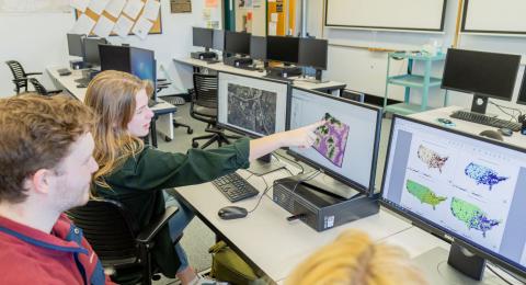
The certificate program will give in-depth knowledge of how to capture, store, manage, manipulate, and analyze geographic information and remotely sensed image data.
- Demonstrate the operational characteristics of GIS.
- Perform geoprocessing and spatial analysis using GIS tools.
- Visually analyze geographic data using 3-D technology.
- Demonstrate and analyze spatial patterns of geographic data using spatial statistics.
- Construct and apply Web GIS tools to GIS projects.
- Demonstrate how to apply GIS to solve real-world issues and problems.
- Design and implement GIS solutions in Python to automate geoprocessing tasks.
- Apply GIS programming skills to analyze and automate tasks of spatial data.
- Perform image enhancement, image interpretation, and automated analysis using digital imagery.
- Perform spatial analysis of remotely sensed image data using GIS and RS tools.
Career Pathways:
- Urban and Regional Planning
- Environmental Science
- Geospatial Information Analysis
- Market Analysis
- Policy Analysis
- Natural Resource Management
- Public Health and Epidemiology
- Military Intelligence, Emergency, and Public Safety
- Real Estate Analysis
Explore Program Details
The certificate program will give in-depth knowledge of how to capture, store, manage, manipulate, and analyze geographic information and remotely sensed image data.
- Demonstrate the operational characteristics of GIS.
- Perform geoprocessing and spatial analysis using GIS tools.
- Visually analyze geographic data using 3-D technology.
- Demonstrate and analyze spatial patterns of geographic data using spatial statistics.
- Construct and apply Web GIS tools to GIS projects.
- Demonstrate how to apply GIS to solve real-world issues and problems.
- Design and implement GIS solutions in Python to automate geoprocessing tasks.
- Apply GIS programming skills to analyze and automate tasks of spatial data.
- Perform image enhancement, image interpretation, and automated analysis using digital imagery.
- Perform spatial analysis of remotely sensed image data using GIS and RS tools.
- Urban and Regional Planning
- Environmental Science
- Geospatial Information Analysis
- Market Analysis
- Policy Analysis
- Natural Resource Management
- Public Health and Epidemiology
- Military Intelligence, Emergency, and Public Safety
- Real Estate Analysis


